A grid the aircraft does not actually fly is a gap, and a probability of detection taken from the wrong coverage is a false plan. The pattern and the spacing decide which of those failures shows up on the chart.
Independent explainer: this site is named after the domain once used by the First Responder UAS Triple Challenge and is not its organizer or affiliated with NIST or the universities involved.
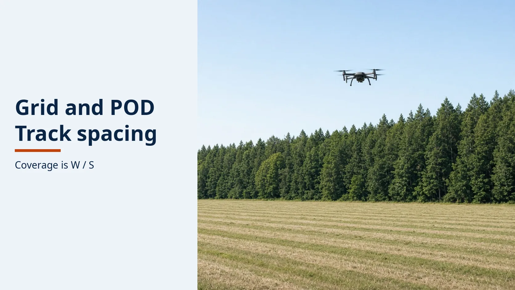
IAMSAR Volume II (2019), Chapter 5, computes the coverage factor of a parallel pattern as C = W/S, where W is the sweep width and S is the track spacing. The same chapter says increasing the spacing lowers that coverage and the probability of detection, and decreasing the spacing does the opposite. An expanding square starts with two legs equal to the spacing. A parallel sweep puts the commence-search point half a spacing inside the corner. A creeping line covers the same kind of rectangle with more turns.
The pattern has to match the datum
| Pattern | What Chapter 5 prints | Dominant failure mode | Prevention |
|---|---|---|---|
| Expanding square (SS) | Datum known with relatively good accuracy. First two legs equal the track spacing. Each later pair is one spacing longer. A repeat is turned 45 degrees. | A precise pattern flown with poor navigation. | Put the first leg into the wind. Do not assign several facilities to the small area at once. |
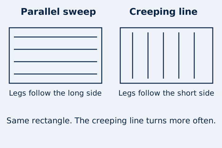
| Parallel sweep (PS) | Large uncertainty, uniform coverage, most effective over water or reasonably flat terrain. Commence-search point is half a track spacing inside the corner. Legs run along the long sides, one spacing apart. | Spacing the facility cannot follow, or a chart that shows tracks the aircraft did not fly. | Confirm the facility can hold the legs. Record the tracks actually flown. |
| Creeping line (CS) | The same rectangle, but the legs run along the short sides. It needs many more turns and is usually less efficient than the parallel sweep. | Using the extra turns when nothing is coordinating the creep. | Prefer the parallel sweep unless an aircraft and a vessel are being coordinated. |
| Sector (VS) | Small circular area around an accurate datum. Aircraft radius usually 5 to 20 nautical miles. Vessel radius usually 2 to 5 nautical miles, with 120-degree turns to starboard. | A second facility at a similar altitude in that small circle. | One facility. If the first pass misses, rotate the next legs halfway between the first set. |
Chapter 5 says a regular pattern improves the probability of detection compared with a random search, especially when conditions are ideal. It also says the pattern has to be inside the facility’s ability to fly it accurately and safely. A drone inherits that test. It does not inherit the vessel radii.
Coverage is sweep width divided by spacing
For the parallel patterns in this chapter, the coverage factor is:
C = W/S
If the sweep width and the coverage you want are already known, the spacing is:
S = W/C
The chapter also prints the effort form, C = Z/A, where Z is the available search effort and A is the area. For a parallel sweep it says the two forms are equivalent. Facilities are not normally handed a coverage number. They are handed a sub-area and a pattern.
The worked example uses a sweep width of 40 metres. Forty metres is an assumed input for the arithmetic. It is not a sweep width printed for a drone, a camera, or a forest.
At a coverage of 1, S = 40/1 = 40 metres. Open the spacing to 80 metres and C = 40/80 = 0.5. Chapter 5 says that increase in spacing lowers coverage and lowers the probability of detection. It does not, in this chapter extract, print the percentage that belongs to a coverage of 0.5. Appendix N is cited for the curves. Those tables are not in the extract used here, so this page does not invent one.
If coverage falls below 1, track spacing is wider than the sweep width. The direction of the change is the manual’s: wider spacing, lower coverage, lower probability of detection. How much lower has to come from the curve for that sensor and those conditions.
The same chapter’s note on navigation is the other half of the formula. A position error of about two miles is described as usually not significant when the sweep width is 20 miles, and as substantial when the sweep width is only two miles. If the aircraft’s cross-track error is on the order of W, the flown legs are not the legs the coverage formula used.
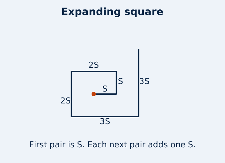
On an expanding square, the first six legs are S, S, 2S, 2S, 3S, and 3S. Their length is 12S. At the assumed 40 metre spacing, 12 × 40 = 480 metres. That is path length for those six legs, not a search area, and not a time on scene. A repeat in the same area is turned 45 degrees. The chapter says this pattern is often appropriate for vessels, small boats, or helicopters searching a low-leeway object, and not necessarily for fixed-wing aircraft. A multirotor can fly the geometry. The note about fixed-wing aircraft is about the pattern’s fit, not a ban written for drones.
The rectangle is either long-legged or short-legged
A parallel sweep starts half a spacing in from the corner. The legs run parallel to the long sides. The next leg is one spacing over. A creeping line uses the short sides as the leg direction, so the same rectangle costs more turns. Chapter 5 says that is usually less efficient unless the aircraft is coordinated with a vessel so that the aircraft’s advance matches the vessel’s speed and the aircraft passes over the vessel at the middle of each leg.
More than one aircraft should not be put in the same sub-area at a similar altitude at the same time. The chapter’s reason is attention and the room to react to a sighting. An electronic search high above a visual search lower down is the exception it allows. Two drones at one height in one cell do not meet that exception.
What this chapter does not hand a drone crew
The sector radii, 5 to 20 nautical miles for aircraft and 2 to 5 nautical miles for vessels, are printed for those craft. Using 5 nautical miles as a drone radius copies the wrong line. The useful sector rules that do travel are the small circle around an accurate datum, one facility in that circle, and a second pass whose legs fall halfway between the first.
Sweep-width tables for flat open terrain, and the correction for ground heavily covered with vegetation, are named as tables N-9 and N-10. They are not printed in this extract. A forest spacing therefore cannot be read off this page. The canopy explainer is where that detection problem is already separated from the pattern geometry. This page stops at the geometry and the coverage formula.
Crews are told to plot the tracks they flew and to tell the search planner how effective they judged the search, given the conditions. A shaded rectangle on a planning map is not that record if the aircraft cut a corner.
When this does not apply
- The datum is a last-known point with little uncertainty and the area is small. Chapter 5 points that case at a sector or an expanding square, not at a large parallel grid.
- The only available detection number was measured over open grass. The chapter says terrain and vegetation change sweep width. The open-grass number is not W for the trees.
- Two drones are being stacked in one sub-area at one altitude to “raise POD.” The chapter discourages that for aircraft.
- A vendor states a probability of detection with no sweep width, no spacing, and no statement of whether the tracks were the planned tracks. C = W/S cannot be checked.
Methods and sources
Pattern names, the leg rules, the commence-search point, the sector radii, the 45-degree repeat, the two-mile position-error comparison, and the formulas C = W/S, S = W/C, and C = Z/A come from the 2019 IAMSAR Volume II Chapter 5 extract filed as INQ010511, retrieved 20 October 2026. The 40 metre sweep width and the 480 metre path are a worked example marked as such. Appendix N percentages are not in the extract and are not supplied here. The search explainer carries the probability-of-success identity and the canopy problem. The archive is the competition record, not a search manual.