Flying a BVLOS drone (Beyond Visual Line of Sight small unmanned aircraft) by relying on extended radio range without a verified airspace deconfliction architecture and obstacle-cleared Return-to-Home (RTH) corridor causes Part 107 waiver applications to fail and creates mid-air collision or unshielded ground-overflight hazards when command links drop. Under 14 CFR § 107.31, unaided human vision is the statutory baseline for tracking aircraft position, determining attitude and altitude, scanning for air traffic, and protecting people on the ground—meaning every civil BVLOS operation must prove with testable engineering evidence how containment boundaries, Visual Observer (VO) handoffs or Detect and Avoid (DAA) sensors, and FCC-approved Command and Control (C2) links replace direct sight without violating the non-waivable collision-hazard ban in 14 CFR § 107.37(b).
UAS Triple Challenge (uastriplechallenge.com) is an independent technical publication named after the domain once used by the 2021–2022 First Responder UAS Triple Challenge prize competition and has no affiliation with NIST, Kansas State University, Mississippi State University, or any aircraft manufacturer. Nothing on this page is an FAA approval, legal opinion, or compliance guarantee.
Operating a civil drone beyond unaided visual sight under 14 CFR Part 107 requires an approved Certificate of Waiver (14 CFR § 107.200 and § 107.205(c)) submitted through the FAA’s interactive Aviation Safety Hub (AVS Hub), while the FAA’s August 6, 2025 BVLOS normalization framework (Part 108) remains a proposed rule. Under the FAA’s June 14, 2024 Waiver Safety Explanation Guidelines (WSEG), a complete BVLOS safety explanation must replace all four statutory duties of 14 CFR § 107.31(a)(1)–(4): (1) continuous telemetry tracking inside a hard-geofenced operational volume (WSEG 1.a–1.b), where ADS-B Out is explicitly rejected for small UAS tracking; (2) verified airspace deconfliction using either Visual Observers scanning a 2-statute-mile (2 sm) radius (WSEG 2.e)—backed by a concurrent waiver to 14 CFR § 107.33(b) and (c)(2) whenever a multi-VO daisy-chain is used—or validated electronic DAA / obstruction shielding (WSEG 2.b & 2.d) paired with anti-collision lighting visible at 1 sm by day and 3 sm at night (WSEG 3.a); (3) an FCC-authorized C2 link (WSEG 7.b, under 47 CFR § 15.247 or 47 CFR Part 88 5040–5050 MHz CNPC rules) range-tested along the intended route (WSEG 1.c); and (4) pre-briefed lost-link RTH trajectories verified to clear vertical obstructions and avoid overflying people or moving vehicles (WSEG 1.e & 4.d).
| Regulatory or Engineering Domain | Governing Rule / FAA WSEG Anchor | Statutory Baseline or Verified Threshold | BVLOS Waiver Evidence Requirement | Dominant Operational Failure Mode |
|---|---|---|---|---|
| Waiver Portal & Review Clock | 14 CFR § 107.200 / FAA Waivers Guidance (2026-06-22) |
Interactive Aviation Safety Hub (AVS Hub); 90-day review target; 30-day RFI deadline |
Submit CONOPS, sUAS containment, personnel training, and WSEG answers in AVS Hub (airspace authorizations stay in FAADroneZone) | Filing in legacy queues or missing the 30-day AVS Hub Request for Information (RFI) window, triggering automatic cancellation |
| Position, Attitude & Containment | 14 CFR § 107.31(a)(1)–(2) / WSEG § 107.31(1)(a)–(b) |
<= 400 ft AGL ceiling (§ 107.51); 5-mile nearby airspace audit; ADS-B Out prohibited for sUA tracking |
Continuous telemetry display of position, altitude, attitude, and heading + verified geofence or tether + immediate flight termination switch | Relying on ADS-B Out to track the drone or omitting hard containment verification inside the mapped latitude/longitude box |
| VO Surveillance & Multi-VO Handoff | 14 CFR § 107.31(b) & § 107.33 / WSEG § 107.31(2)(e) & § 107.33(1) |
2 statute miles (2 sm) VO airspace scan radius around sUA in flight |
Single VO keeping VLOS throughout flight needs § 107.31(b)(2) compliance; multi-VO daisy-chain requires waiving § 107.33(b) & (c)(2) + latency budget |
Deploying a linear relay of VOs under a § 107.31-only request without waiving § 107.33(b)/(c)(2) or bounding RPIC–VO comm failure |
| Electronic DAA, Shielding & Lighting | 14 CFR § 107.31(a)(3) & § 107.37(b) / WSEG § 107.31(2)(b)–(d) & (3)(a) |
§ 107.37(b) is non-waivable; strobe visible >= 1 sm day / >= 3 sm night |
Address 17 WSEG DAA items (radar/acoustic/visual, RTCA/ASTM alignment, low-altitude coverage, ADS-B In, audible/visual alerts) or shielding criteria/safe states |
Claiming generic obstacle avoidance cameras or ADS-B In alone satisfy non-cooperative aircraft detection at closing speeds |
| C2 Link Grant & Lost-Link RTH Profile | 14 CFR § 107.31(a)(4) / WSEG § 107.31(1)(c), (1)(e), (4)(d), (7)(b) / 47 CFR Part 88 |
FCC equipment approval ID required; Part 88 NNA CNPC at 5040–5050 MHz (5040–5060 MHz interim) |
Document FCC approval number, test and verify C2 capability along the route, provide audible/visual link alerts, and clear RTH path of obstacles and people | Straight-line automated RTH climbing into a ridge/tower or transiting directly over an active highway or open-air assembly |
| Commercial Property Carriage Limit | 14 CFR § 107.205(c) (86 FR 4387) |
Strict statutory exclusion under Part 107 waiver rules | No waiver of § 107.31 will be issued to allow the carriage of property of another by aircraft for compensation or hire |
Submitting a Part 107.31 operational waiver to conduct third-party commercial package delivery for hire |
What a Part 107.31 BVLOS waiver actually replaces: the four duties of unaided vision
A Part 107 Beyond Visual Line of Sight waiver succeeds only when the applicant replaces each of the four specific safety functions that the Federal Aviation Administration assigns to the human eye under 14 CFR § 107.31. In standard Visual Line of Sight (VLOS) operations, § 107.31(a) mandates that—with vision unaided by any device other than corrective lenses (eyeglasses or contact lenses; binoculars, onboard camera feeds, and first-person-view goggles do not count as unaided vision)—the Remote Pilot in Command (RPIC), the visual observer (VO, if one is used), and the person manipulating the flight controls must be able to see the unmanned aircraft throughout the entire flight in order to:
- Know the unmanned aircraft’s location (
14 CFR § 107.31(a)(1)): Replaced in a BVLOS architecture by continuous, high-integrity ground control station (GCS) position telemetry, pre-surveyed latitude/longitude boundary mapping, and verified containment (WSEG § 107.31(1)(a)–(b)). - Determine the unmanned aircraft’s attitude, altitude, and direction of flight (
14 CFR § 107.31(a)(2)): Replaced by real-time attitude heading reference system (AHRS), barometric/geometric altitude, and groundspeed/track indicators with audible and visual degraded-function alerts (WSEG § 107.31(1)(a)&(4)(a)–(c)). - Observe the airspace for other air traffic or hazards (
14 CFR § 107.31(a)(3)): Replaced by a2-statute-mileradius human VO surveillance network (WSEG § 107.31(2)(e)), a validated ground-based or airborne Detect and Avoid (DAA) sensor suite integrated withADS-B In(WSEG § 107.31(2)(b)(1)–(17)), or an obstruction-shielded operating volume with defined safe states (WSEG § 107.31(2)(b)(12)&(2)(d)). - Determine that the unmanned aircraft does not endanger the life or property of another (
14 CFR § 107.31(a)(4)): Replaced by surface area monitoring, population access controls, impact mitigations (Category 1–4compliance or parachute systems where applicable), and pre-verified lost-link Return-to-Home (RTH) and flight-termination trajectories (WSEG § 107.31(1)(e)&(2)(c)).
In the historical 2021–2022 NIST PSCR competition documented in the First Responder UAS Triple Challenge archive, the contest FAQ prohibited BVLOS flight altogether and required direct visual line of sight at all times—even as competing teams engineered search-and-rescue (Challenge 3.1 FastFind), non-cellular IP communications (Challenge 3.2 LifeLink), and navigation cyber-hardening (Challenge 3.3 Shields Up!) prototypes. When public-safety agencies and civil inspection operators transition those mission profiles into real-world beyond-visual-line-of-sight deployments, they leave the contest sandbox and must satisfy 14 CFR § 107.200 and § 107.205.
Filing in the FAA Aviation Safety Hub (AVS Hub) and current regulatory boundaries
Before drafting a single risk-mitigation paragraph, engineering leads must align their submission with three current statutory and procedural rules verified from FAA and eCFR sources:
- Operational Waivers Now Use the Aviation Safety Hub (
AVS Hub), Not FAADroneZone: According to the FAA Part 107 Waivers portal guidance (last updated June 22, 2026), the Part 107 operational waiver application process has transitioned to an interactive system, the Aviation Safety Hub (AVS Hub). Part 107 airspace authorizations (14 CFR § 107.41) remain in FAADroneZone, and previously submitted waivers require no action, but all new§ 107.31and§ 107.33waiver applications are filed by logging intoAVS Hub. - The
90-DayTarget Review Clock and30-DayRFI Cancellation Rule: The FAA states on its Part 107 Waivers page that it aims to review and approve or disapprove waiver requests within90 daysof submission, depending on complexity and initial completeness. If FAA analysts need additional engineering proof, they send a Request for Information (RFI) viaAVS Hub(triggering a status-change email to the listed responsible person). If the applicant does not log intoAVS Huband respond to an RFI within30 days, the application is automatically canceled and must be resubmitted from scratch. - Proposed Part 108 vs. Active Part 107 Waiver Rules, Plus Non-Waivable Exclusions: On August 6, 2025, the FAA announced its proposed rule for normalizing BVLOS drone operations covering operations, aircraft manufacturing, airspace separation, operational authorizations, and security. Because that rulemaking is a proposed rule and not yet an effective operating regulation, civil operators under Part 107 must still obtain an approved
§ 107.31Certificate of Waiver. Furthermore, two statutory boundaries cannot be crossed via a Part 107.31 waiver:- No Carriage of Property of Another for Compensation or Hire (
14 CFR § 107.205(c)): While§ 107.205(c)lists§ 107.31as subject to waiver, it explicitly states: “However, no waiver of this provision will be issued to allow the carriage of property of another by aircraft for compensation or hire.” - No Waiver of the Collision-Hazard Ban (
14 CFR § 107.37(b)): Although§ 107.37(a)(yielding the right of way) appears on the waivable list in§ 107.205(f), FAA Flight Standards Service BVLOS guidance (A6) underscores that14 CFR § 107.37(b)(“No person may operate a small unmanned aircraft so close to another aircraft as to create a collision hazard”) is not subject to waiver, and the FAA does not issue a§ 107.31waiver unless the proposed operation maintains the minimum level of collision safety required by§ 107.37.
- No Carriage of Property of Another for Compensation or Hire (
Rule of thumb (
AVS Hubvs. EmergencySGIRouting): If a public-safety agency or utility operator requires standing, repeatable BVLOS corridor authority under Part 107, submit a full WSEG safety explanation in the FAA Aviation Safety Hub (AVS Hub) at least90 daysprior to target deployment. If a first-responder crew faces an active natural disaster, wildfire, or life-safety search-and-rescue incident requiring immediate beyond-visual-line-of-sight relief today, use the FAA’s expedited Special Governmental Interest (SGI) process via the System Operations Support Center (202-267-8276) detailed in our emergency drone authorization (SGI) checklist—noting that emergency BVLOS requests typically require a Temporary Flight Restriction (TFR) and longer processing than visual-line-of-sight SGI addendums.
Takeaway: Structure every BVLOS safety explanation around the four statutory functions of 14 CFR § 107.31(a)(1)–(4), file new applications in the FAA Aviation Safety Hub (AVS Hub) rather than FAADroneZone, and verify that the mission does not involve commercial third-party property delivery excluded by § 107.205(c).
CONOPS operational volume: containment geometry, ground risk, and RTH clearance
Under Section 1 (General, questions 1.a–1.e) of the FAA Part 107 Waiver Safety Explanation Guidelines (WSEG, June 14, 2024) and the AVS Hub operational prompts, the FAA evaluates where the aircraft can physically go during normal flight, degraded telemetry, and complete command-link loss before reviewing any airspace sensor specs.
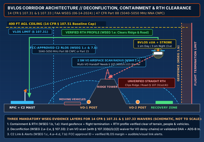
Five mandatory containment and surface-protection proofs (WSEG 1.a, 1.b, 1.d, 1.e, 2.c)
- Mapped Operational Volume &
5-MileAirspace Audit (AVS HubOperational Details &WSEG 1.d): The application must define the exact flight route and operational polygon using latitude/longitude coordinates and a detailed map, state the maximum altitude above ground level (<= 400 ft AGLbaseline under14 CFR § 107.51(b)), identify whether the volume intersects controlled airspace (Class B, C, D, or surface Class Erequiring§ 107.41authorization), catalogue all other airspace and heliports/airports within5 milesof any planned flight area, and classify the surface environment (rural, sparsely populated, restricted-access industrial site, or congested area). - Position Tracking Without
ADS-B Out(WSEG 1.a&A6): The applicant must explain how the RPIC continuously determines the sUA’s position, altitude, attitude, and movement. FAA Flight Standards Service guidance (A6, slide 4) explicitly warns applicants:ADS-B Outis not an accepted solution to track a small unmanned aircraft under§ 107.31(a)(1)(and standard Part 107 aircraft are generally prohibited from broadcastingADS-B Outunless operating under specific air traffic authorization to prevent saturating1090 MHz/978 MHzair traffic control frequencies). Primary tracking must come from the sUAS telemetry downlink over an FCC-compliant C2 architecture, reinforced by onboard GNSS/INS navigation whose spoofing and jamming resilience is covered in our UAS navigation security explainer. - Positive Containment Verification & Flight Termination (
WSEG 1.b&AVS HubsUAS Details):WSEG 1.basks two distinct questions: how the RPIC ensures the sUA remains in the area of intended operation (for example, onboard 3D polygon geofencing or a physical tether), and how that containment is verified prior to BVLOS flight (such as pre-flight software boundary checksum verification and VLOS boundary-fence test stops). In addition,AVS Hubasks what kind of flight termination system the sUAS carries (such as an independent immediate flight termination switch or parachute deployment trigger) if the aircraft breaches the outer containment buffer. - Surface Monitoring & Abnormal-Situation Overflight Ban (
WSEG 2.c&A6): UnderWSEG 2.cand§ 107.31(a)(4), the applicant must prove how the RPIC monitors the surface of the operating area so the sUA never overflies non-participating people (14 CFR § 107.39) or moving vehicles (14 CFR § 107.145), or else demonstrate how the aircraft is certified safe to operate over them (Category 1–4compliance, documented safe operational history, impact mitigation such as an ASTM-compliant parachute, or strictly access-controlled surface property). FAA Flight Standards (A6, slide 11) emphasizes that this protection applies even in abnormal situations, and that using a calculated statistical probability of overflying a person is not an acceptable means to comply with§ 107.39. - Return-to-Home (
RTH) Obstacle and Overflight Clearance (WSEG 1.e):WSEG 1.etargets one of the most frequent field failure modes in BVLOS operations: “Does the sUA have a return to home (RTH) function? If so, how does the RPIC ensure the sUA does not overfly people/vehicles or collide with obstructions during the RTH flight?” If a drone loses its C2 link3 kmdown a curved river or utility corridor and executes a default straight-line"crow-flies"RTH toward the launch pad, the diagonal return path can cut across an intervening hill, clip a180 fttransmission tower, or cross an active highway outside the surveyed corridor. A compliant CONOPS either programs corridor-following RTH waypoints / pre-surveyed emergency landing zones along the route or proves that the RTH ceiling (H_RTH) and lateral corridor remain strictly inside the cleared, access-controlled volume.
Kinematic containment and RTH clearance equations
To verify both vertical RTH clearance (WSEG 1.e) and the lateral containment buffer (D_buffer, WSEG 1.b) between the soft geofence warning line and the hard flight-termination boundary, flight engineers bound the worst-case horizontal excursion during a lost-link or degraded-navigation event:
H_max_obstacle + ΔH_baro_error + ΔH_safety <= H_RTH <= 400 ft AGL
D_buffer >= (V_ground_max + V_wind_tail) × (t_link_timeout + t_FTS_response) + (V_ground_max + V_wind_tail)^2 / (2 × a_brake) + 2 × σ_GNSS
Where:
H_max_obstacleis the tallest terrain feature, tree canopy, or structure along the entire RTH trajectory (ft AGLrelative to the launch/reference point).ΔH_baro_erroris the barometric/GNSS altitude drift allowance over the sortie duration (ft), andΔH_safetyis the vertical clearance margin above obstacles (ft).H_RTHis the programmed Return-to-Home transit altitude (ft AGL), which must stay at or below the400 ft AGLPart 107 ceiling (14 CFR § 107.51(b)) unless flying within400 ftof a structure or under a§ 107.51waiver.V_ground_maxis the sUA’s maximum programmed groundspeed (m/s, capped at100 mph = 44.70 m/sunder§ 107.51(a)), andV_wind_tailis the maximum operating tailwind component (m/s,WSEG 6.a).t_link_timeoutis the operator-configured C2 lost-link detection timer (s) before automated hover/RTH triggers, andt_FTS_responseis the alert-plus-execution delay (s) to trigger immediate flight termination if the aircraft fails to decelerate at the geofence.a_brakeis the aircraft’s verified horizontal braking deceleration (m/s²), and2 × σ_GNSSis the95%horizontal position uncertainty (m).
Worked containment and RTH corridor verification example
Consider a public-safety or utility inspection multirotor flying a 2.5 km rural right-of-way corridor at a programmed cruise groundspeed of V_ground_max = 12.0 m/s (26.8 mph) in a maximum allowed wind of V_wind_tail = 8.0 m/s (17.9 mph, worst-case downwind groundspeed 20.0 m/s). Along the corridor, the tallest pine canopy and utility poles reach H_max_obstacle = 135 ft AGL, barometric drift over a 30-minute sortie is bounded at ΔH_baro_error = 25 ft, and the operator enforces a minimum vertical obstacle clearance of ΔH_safety = 100 ft:
- Vertical RTH Window (
WSEG 1.e): Minimum safe RTH altitude is135 ft + 25 ft + 100 ft = 260 ft AGL. SettingH_RTH = 300 ft AGLkeeps the aircraft140 ftabove the tallest corridor obstacle while preserving a100 ftvertical buffer below the400 ft AGLPart 107 ceiling. To prevent diagonal shortcut overflight of a parallel county road, the autopilot is configured to retrace surveyed corridor waypoints back to the launch pad (or land vertically at one of three pre-surveyed, access-controlled recovery pads if battery reserve drops below the return threshold). - Lateral Geofence-to-Termination Buffer (
WSEG 1.b): With a configured C2 lost-link timeout oft_link_timeout = 3.0 s, an RPIC/automated boundary termination response oft_FTS_response = 2.0 s, horizontal braking decelerationa_brake = 4.0 m/s², and horizontal GNSS uncertainty2 × σ_GNSS = 3.0 m:D_buffer = (20.0 m/s × (3.0 s + 2.0 s)) + (20.0 m/s)^2 / (2 × 4.0 m/s²) + 3.0 m = 100.0 m + 50.0 m + 3.0 m = 153.0 m(~502 ft). Setting the inner soft geofence160 m(525 ft) inside the outer controlled-property boundary guarantees that even a downwind runaway detected at the link timeout is arrested or terminated before crossing into non-participating surface property.
Takeaway: Never leave a BVLOS aircraft on a factory-default straight-line RTH setting; verify that H_RTH clears all vertical obstructions below 400 ft AGL, program corridor-following return waypoints or pre-surveyed recovery zones to prevent road/crowd overflight (WSEG 1.e), and size the lateral geofence buffer (WSEG 1.b) for worst-case downwind stopping distance.
Airspace deconfliction architectures: Visual Observer handoffs (§ 107.33) vs. electronic DAA and shielding
Satisfying 14 CFR § 107.31(a)(3) (“Observe the airspace for other air traffic or hazards”) and the non-waivable collision-hazard prohibition in 14 CFR § 107.37(b) is the core engineering hurdle of any BVLOS application. Across the June 2024 WSEG (Section 2.a–2.e and § 107.33), the FAA evaluates four distinct operational architectures for low-altitude airspace deconfliction.
| Airspace Deconfliction Architecture | Waivers Required in AVS Hub |
Primary FAA WSEG Evidence Requirements (06-14-2024) |
Airspace Surveillance & Conspicuity Envelope | Operational Boundary & Primary Failure Mode |
|---|---|---|---|---|
1. Single-VO Extended Line of Sight (EVLOS Baseline) |
14 CFR § 107.31 (when RPIC loses unaided sight and relies on VO + instruments) |
WSEG § 107.31(2)(e) & § 107.33(1)(a)–(c): Prove continuous effective RPIC–VO communication, comm latency allowance, and comm-loss abort procedure |
Both RPIC/VO or the VO maintains continuous unaided sight of the sUA throughout flight (§ 107.31(b)(2)) + 2 sm airspace scan radius around the sUA |
Fails if the sUA flies beyond the single VO’s unaided visual acquisition range or if RPIC–VO voice channel drops without an immediate hover/land trigger |
2. Multi-VO Daisy-Chain (Linear Corridor Relay) |
14 CFR § 107.31 AND 14 CFR § 107.33(b) & (c)(2) |
WSEG § 107.33 Note & 1.a–1.c: Because not all VOs see the sUA for the entire flight, waive § 107.33(b) & (c)(2); quantify multi-hop comm latency and failure alerts |
Overlapping 2 statute mile (2 sm) airspace surveillance sectors around the sUA + 1 sm day / 3 sm night anti-collision strobe (WSEG 3.a) |
Applying only for § 107.31 while using a VO relay, leaving § 107.33(b)/(c)(2) unwaived; or uncoordinated sector handoff gaps between distant VOs |
3. Electronic Detect and Avoid (Ground or Airborne DAA) |
14 CFR § 107.31 |
WSEG § 107.31(2)(b)(1)–(17): Answer all 17 DAA questions (radar/acoustic/visual, RTCA/ASTM alignment, low-altitude coverage, ADS-B In, audible/visual alerts) |
Validated detection range D_detect >= D_min_avoid for both cooperative (ADS-B In) and non-cooperative traffic up to max AGL ceiling + 1 sm / 3 sm strobe |
Relying solely on ADS-B In (which misses non-cooperative crop dusters, helicopters, and ultralights) or ground radar with terrain blind spots at low AGL |
4. Obstruction / Shielded Operations (Infrastructure / Canopy Envelope) |
14 CFR § 107.31 |
WSEG § 107.31(2)(b)(12) & (2)(d): Define explicit shielding criteria (vertical/lateral distance to structures/trees) and safe states during alerts or failures |
Operation remains strictly inside the defined shielded volume adjacent to structures/obstructions where crewed aircraft do not operate + 1 sm / 3 sm strobe |
Breaking out of the defined vertical/lateral shielding envelope during a waypoint turn or triggering an unshielded vertical RTH climb into open airspace |
Why a multi-VO daisy-chain requires waiving 14 CFR § 107.33(b) and (c)(2)
A widespread compliance error in linear infrastructure inspection (powerlines, pipelines, railways, and river corridors) is assuming that stationing a chain of Visual Observers every 1 to 1.5 miles along a corridor either requires no waiver at all or requires only a § 107.31 waiver.
Read 14 CFR § 107.33 alongside the explicit Note in the FAA’s June 14, 2024 WSEG (sources/A3.txt, lines 196–203):
- Under standard
14 CFR § 107.33(b), the RPIC must ensure that the VO is able to see the unmanned aircraft in the manner specified in§ 107.31(which requires seeing the unmanned aircraft throughout the entire flight). - Under
14 CFR § 107.33(c)(2), the RPIC, person manipulating the controls, and VO must coordinate to maintain awareness of the position of the small unmanned aircraft through direct visual observation. - Therefore, as the WSEG
§ 107.33Note explicitly states: “If a VO is part of your operation, § 107.31 requires that all VO(s) be able to see the small unmanned aircraft (sUA) throughout the duration of the flight. You may need a waiver to certain portions of § 107.33 (specifically § 107.33(b) and § 107.33(c)(2)) if your operation requires the use of multiple VOs, not all of which will be able to maintain visual line of sight with your sUA. An example of operations where this may apply is when using a daisy-chain of VOs (where VO(s) maintain direct visual contact with the sUA throughout the entire flight in place of the RPIC doing so).”

When applying for a VO-supported BVLOS waiver (§ 107.31 plus § 107.33(b) and (c)(2) for multi-VO relays), the WSEG requires proving four human-in-the-loop parameters:
2-Statute-Mile(2 sm) Airspace Surveillance Radius (WSEG § 107.31(2)(e)&A6): WSEG2.easks whether the VO(s) will be able to maintain visual surveillance of2 statute miles (sm)around the sUA’s position and/or maintain VLOS with the sUA at all times. FAA Flight Standards (A6, slide 7) explains that2 statute miles(3,218.7 m) is supported by human-factors research as the minimum safe distance to visually detect an approaching aircraft with sufficient time to execute an avoidance maneuver when humans perform the"Detect"role in DAA. Crucially,A6notes that the2 smdetection radius does not by itself guarantee the"Avoid"requirement—operators may need to station the sUA closer to the VO/RPIC so the drone can clear the flight path before an intruder arrives.- RPIC–VO Communication Latency Budget (
WSEG § 107.33(1)): The applicant must quantify communication latency between distant VOs and the RPIC (for example, dedicated full-duplex VHF/UHF radios vs. push-to-talk repeater channels) and show that total detection-plus-communication-plus-maneuver time fits inside the2 smdetection window. - Distant Communication Failure Alerts & Abort Procedures (
WSEG § 107.33(1)(b)–(c)): If the communication link between the RPIC and any active sector VO fails, both the RPIC and VO must be alerted immediately (such as continuous squelch/pilot-tone monitoring or timed heartbeat check-ins every15–30 seconds), and the RPIC must execute an immediate safe-state maneuver (hover, descend into a shielded altitude, or land at a pre-surveyed recovery zone).
Kinematic closing-speed and minimum detection distance equation (WSEG 2.b.11 & 2.e)
Whether airspace surveillance is performed by a Visual Observer scanning 2 statute miles (WSEG 2.e) or by an electronic DAA radar/optical sensor (WSEG 2.b.5 & 2.b.11), the minimum required detection distance D_min_detect must exceed the distance closed by an approaching crewed aircraft during the total system response time T_total_avoid plus the required well-clear separation buffer D_well_clear:
T_total_avoid = t_sensor_or_VO + t_comm_latency + t_RPIC_decision + (Δh_descent / V_descent_sUA)
D_min_detect = (V_intruder + V_sUA) × T_total_avoid + D_well_clear
Where:
V_intruderis the groundspeed of an approaching low-altitude crewed aircraft (m/s; for example, a helicopter, agricultural sprayer, or medevac aircraft flying at110 kt = 56.59 m/s).V_sUAis the closing groundspeed of the drone (m/s; up to100 mph = 44.70 m/sunder§ 107.51(a)).t_sensor_or_VOis the visual scan acquisition or DAA tracker confirmation time (s),t_comm_latencyis the VO-to-RPIC voice or DAA alert transport delay (s), andt_RPIC_decisionis the pilot reaction time (s) to command an evasive descent.Δh_descent / V_descent_sUAis the time (s) required for the drone to descend byΔh_descent(m) at vertical descent rateV_descent_sUA(m/s) into a safe low-altitude hover or landing zone.
Worked closing-speed and VO comm-latency calculation
Suppose a BVLOS inspection quadcopter cruises at V_sUA = 15.0 m/s (33.6 mph) at 350 ft AGL (106.7 m) while a low-altitude helicopter approaches head-on at V_intruder = 56.6 m/s (110 kt). Combined head-on closing speed is V_close = 56.6 + 15.0 = 71.6 m/s (160.2 mph, or 1 statute mile every 22.5 seconds). To clear the airspace down to a 50 ft AGL (15.2 m) tree-shielded hover (Δh_descent = 300 ft = 91.4 m) at a safe vertical descent rate of V_descent_sUA = 3.5 m/s:
- Descent Execution Time:
91.4 m / 3.5 m/s = 26.1 s. - Total Avoidance Time (
T_total_avoid): With VO visual acquisition and bearing calloutt_sensor_or_VO = 4.0 s, distant VO-to-RPIC radio latencyt_comm_latency = 2.5 s, and RPIC throttle responset_RPIC_decision = 2.0 s, total avoidance time isT_total_avoid = 4.0 + 2.5 + 2.0 + 26.1 = 34.6 s. - Minimum Detection Distance (
D_min_detect): During34.6 sat71.6 m/sclosing speed, the two aircraft close by71.6 m/s × 34.6 s = 2,477.4 m(1.54 statute miles). Adding a horizontal/slant well-clear separation buffer ofD_well_clear = 600 m(0.37 sm) yieldsD_min_detect = 3,077.4 m(1.91 statute miles). - Engineering Interpretation: This kinematic derivation shows exactly why WSEG
§ 107.31(2)(e)and FAA Flight Standards (A6) benchmark human VO surveillance at a2-statute-mile(3,218.7 m) radius—and why adding even5 to 8 secondsof unmitigated cellular or multi-hop relay delay between a distant VO and the RPIC erases the0.09 sm(141 m) margin and forces the operator either to reduce cruise altitude (lowering Δh_descent) or position the sUA closer to the VO.
The 17-point WSEG checklist for electronic DAA and anti-collision lighting (WSEG 2.b & 3.a)
When an applicant proposes an electronic Detect and Avoid (DAA) system instead of—or in combination with—Visual Observers, WSEG § 107.31(2)(b)(1)–(17) requires answering 17 specific engineering questions in AVS Hub:
- Modality, Placement & Standards (
2.b.1–3, 6): Specify whether the DAA sensor is RADAR, ACOUSTIC, or VISUAL (2.b.1), whether it is ground-based or airborne (2.b.2), whether it complies with an Industry-Based DAA Performance Standard or combination of standards such as portions of RTCA and ASTM (2.b.3), and how it has been tested and proven reliable in the desired operating environment (2.b.6). - Detection Envelope vs. Avoidance Geometry (
2.b.4–5, 7–9, 11): If ground-based, prove adequate low-altitude DAA coverage across terrain and clutter (2.b.4); state the maximum effective detection distance (2.b.5), the maximum sUA AGL altitude (2.b.7), the avoidance strategy (2.b.8), safeguards against undesired behavior if avoidance is automated (2.b.9), and the minimum detection distance required to carry out the avoidance maneuver (2.b.11, derived via the closing-speed equation above). - Cooperative & Non-Cooperative Traffic Integration and RPIC Alerts (
2.b.10, 13–17): Detail the RPIC interface (2.b.10), system operating limitations (2.b.13), howADS-B Inis integrated (2.b.14), the alerting criteria for both non-cooperative intruders and ADS-B-equipped intruders (2.b.15), and how the system provides both visible and audible alerts to the RPIC for operating-area intruders (2.b.16) as well as for DAA system failures or degradation (2.b.17). - Obstruction / Shielded Operations (
2.b.12&2.d): If using an obstruction or shielded DAA concept of operations (flying closely adjacent to utility structures, bridges, or forest canopy where crewed traffic cannot physically fly), the applicant must define the exact shielding criteria (2.b.12) and the safe states (2.d) the aircraft enters when an intruder or system anomaly is detected. - Anti-Collision Lighting Conspicuity (
WSEG 3.a): Regardless of whether deconfliction relies on VOs, DAA, or shielding,WSEG § 107.31(3)(a)requires describing the anti-collision lighting installed on the sUA so crewmembers in other aircraft can see the drone from at least1 statute mile (sm)during daytime operations and3 statute miles (sm)during nighttime operations.
Rule of thumb (Cooperative vs. Non-Cooperative Airspace Surveillance): If a BVLOS drone carries only an
ADS-B Inreceiver and short-range optical obstacle-avoidance cameras, it does not have a complete open-airspace DAA solution underWSEG § 107.31(2)(b): low-altitude agricultural aircraft, helicopters, gliders, and ultralights operating in Class G airspace may not transmitADS-B Out. Either pairADS-B Inwith a validated non-cooperative sensor (ground/airborne radar, acoustic, or long-range optical DAA meetingWSEG 2.b.1–17), restrict the flight envelope to a defined obstruction-shielded volume (WSEG 2.b.12&2.d), or maintain2-statute-mileVO surveillance (WSEG 2.e).
Takeaway: Match your airspace deconfliction proof to the exact regulatory clauses triggered by your route—adding a 14 CFR § 107.33(b) and (c)(2) waiver whenever multiple VOs hand off visual sight along a daisy-chain, or answering all 17 WSEG 2.b questions when deploying electronic DAA.
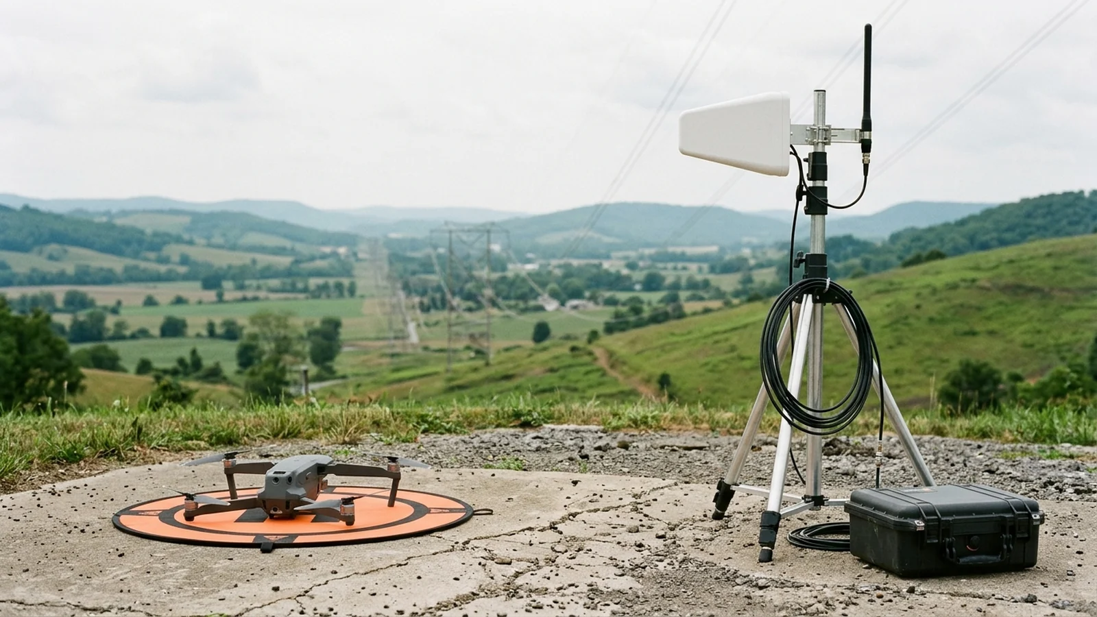
C2 link verification, FCC authorization, and lost-link contingency design
A beyond-visual-line-of-sight aircraft is only as controllable as its Command and Control (C2) link across the worst terrain masks on its route. In the June 2024 WSEG for § 107.31, the FAA audits C2 engineering across three connected sections: 1.c (Range Capability & Verification), 4.a–4.d (Degraded-State Alerts & Lost-Link Procedures), and 7.a–7.b (C2 Architecture & FCC Equipment Authorization).
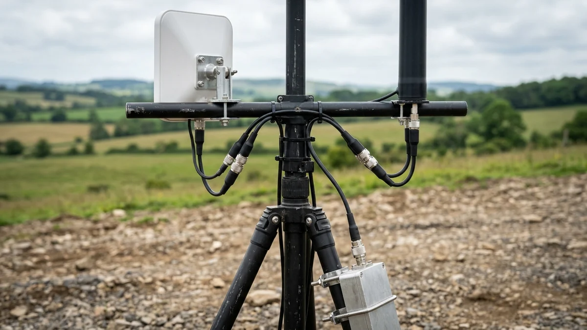
FCC equipment authorization (WSEG 7.b) and 47 CFR Part 88 CNPC spectrum
Question 7.b of the FAA’s § 107.31 WSEG asks directly: “Is the command and control link configuration FCC approved? If so, please provide the approval number?”
As detailed in our C2 link frequencies and redundancy explainer, U.S. BVLOS operators must distinguish between two FCC regulatory regimes when documenting WSEG 7.a–7.b:
- Unlicensed Intentional Radiators (
47 CFR § 15.247—902–928 MHz,2400–2483.5 MHz, and5725–5850 MHz): Most commercial small UAS radios operate under47 CFR § 15.247, where digital-modulation peak conducted output is capped at1 W(+30 dBm) and directional antenna gain above6 dBion a non-fixed-point-to-point mobile aircraft link requires a1 dBconducted-power reduction for every1 dBabove6 dBi(keeping maximum compliant EIRP at+36 dBm). In a BVLOS waiver application, the operator must list the exact FCC Identifier (FCC ID) printed on the transmitter grant, verify that any external antennas or amplifiers match the authorized system grant (47 CFR § 15.204(d)), and account for shared-band noise floors and the7.66 dBfree-space path loss penalty when failing over from2.4 GHzto5.8 GHz. - Interference-Protected Non-Networked Access (
47 CFR Part 88—5030–5091 MHzUAS Allocation): Under the FCC’s Spectrum Rules and Policies for the Operation of Unmanned Aircraft Systems (90 FR 1380,FCC 24-91, published January 8, 2025),47 CFR Part 88establishes Non-Networked Access (NNA) for Control and Non-Payload Communications (CNPC)—defined in§ 88.5as any transmission between the uncrewed aircraft component and the UAS ground station that supports the safety or regularity of the flight. Under47 CFR § 88.25(a), transmissions over an NNA assignment are restricted strictly toCNPC(mission video and payload data are excluded), with5040–5050 MHzdesignated for NNA CNPC (§ 88.29(a)) and5040–5060 MHzopened under the Interim Access Mechanism (IAM,§ 88.29(b)) prior to the first Dynamic Frequency Management System (DFMS) administrator, subject to RTCADO-362Atechnical standards (§ 88.101).
Why the FAA requires route-specific C2 testing and lost-link timing (WSEG 1.c & 4.a–4.d)
Neither 14 CFR § 107.31 nor the June 2024 WSEG prescribes a single universal packet-loss percentage or a fixed millisecond timeout for all drones. Instead, the FAA requires the operator to engineer, test, and lock down three coupled C2 controls for the specific route:
- Pre-BVLOS Link Capability Testing & Verification (
WSEG 1.c): The applicant must explain how the RPIC ensures the flight will not exceed C2 link capabilities and how that limit is tested and verified. In practice, this requires modeling radio line-of-sight (RLOS) and first-Fresnel-zone clearance over the route’s digital elevation profile, establishing a minimum received signal strength indicator (RSSI) / link-quality margin above the receiver sensitivity threshold, and verifying link stability during progressive VLOS range check flights before transitioning to BVLOS. - Audible and Visual Degraded-Function Alerts (
WSEG 4.a–4.c): UnderWSEG 4.aand4.b, the ground station must provide both audible and visual alerts to the RPIC whenever the C2 link (uplink command rate or downlink telemetry packet rate) or any primary flight subsystem degrades below the operator’s warning threshold, paired with a written crew procedure (WSEG 4.c, such as pausing forward mission progress, climbing within the cleared ceiling to restore RLOS, or commanding an immediate Precautionary Return). - Deterministic Lost-Link Procedure (
WSEG 4.d&1.e): If the C2 link drops completely beyond the operator’s configured lost-link timer (t_link_timeout),WSEG 4.drequires a deterministic automated response:- Short-Timeout Loiter / Reconnect Window (e.g.,
2 to 5 s): The aircraft arrests forward velocity, holds position in a stationary hover (or tight loiter circle for fixed-wing), and attempts C2 re-acquisition across its primary and backup frequencies. - Extended Lost-Link Contingency (
WSEG 1.e): If the link is not restored within the loiter window, the aircraft executes the pre-briefed corridor-followingRTHprofile (or lands at the nearest pre-surveyed, access-controlled recovery pad) without overflying people, moving vehicles, or vertical obstructions.
- Short-Timeout Loiter / Reconnect Window (e.g.,
Takeaway: Document the exact FCC ID (WSEG 7.b), prove radio line-of-sight and link margin by field verification (WSEG 1.c), configure dual audible/visual degraded-link alarms (WSEG 4.b), and bind the lost-link timer (WSEG 4.d) directly to the obstacle-cleared RTH corridor (WSEG 1.e).
BVLOS CONOPS, Visual Observer, and C2 link evidence checklist
Use this six-domain verification checklist when compiling a Part 107 BVLOS safety explanation for the FAA Aviation Safety Hub (AVS Hub) or auditing a public-safety / civil inspection crew prior to flight. Every row maps directly to the June 14, 2024 FAA WSEG (A3) and June 22, 2026 AVS Hub operational requirements (A5).
| Evidence Domain | WSEG / CFR Reference | Required Engineering Record in CONOPS | Pre-Flight Verification Method | Hard No-Go / Disapproval Trigger |
|---|---|---|---|---|
| 1. Operational Volume & Containment | 14 CFR § 107.31(a)(1) / WSEG 1.b, 1.d / AVS Hub Operational & sUAS Details |
Lat/lon polygon map, max AGL ceiling (<= 400 ft AGL), controlled airspace check (§ 107.41), 5-mile nearby airspace/airport audit, surface population class, 3D geofence + immediate flight termination switch |
Verify active 3D geofence coordinates and altitude cap in GCS; test flight-termination switch continuity; confirm lateral buffer D_buffer covers downwind stopping distance |
Missing lat/lon boundary or 5-mile airspace audit; unverified geofence; or commercial carriage of another’s property for hire (§ 107.205(c)) |
| 2. Telemetry & Position Tracking | 14 CFR § 107.31(a)(1)–(2) / WSEG 1.a, 4.a–4.c / A6 Slide 4 |
Continuous GCS display of sUA position, altitude, attitude, heading, and groundspeed + audible and visual alerts for degraded navigation or aircraft functions | Confirm primary GNSS/INS lock, barometric altitude zeroing at launch pad, and audible/visual telemetry-loss alarm volume prior to takeoff | Relying on ADS-B Out to track the sUA (explicitly rejected by FAA A6), or flying with silent/visual-only degraded-state warnings |
3. Airspace Deconfliction (DAA / Shielding / 2 sm VO) |
14 CFR § 107.31(a)(3) & § 107.37(b) / WSEG 2.a–2.e, 3.a |
Either 2 sm VO scan radius (2.e), 17-point electronic DAA (2.b.1–17: radar/acoustic/visual, RTCA/ASTM, low-alt coverage, ADS-B In, audible/visual intruder & failure alerts), or shielding criteria & safe states (2.b.12, 2.d) + 1 sm day / 3 sm night strobe (3.a) |
Test strobe conspicuity (>= 1 sm day / >= 3 sm night), verify ADS-B In + non-cooperative DAA sensor status or VO 2 sm visibility, and confirm D_min_detect exceeds closing-speed distance |
Claiming ADS-B In or short-range obstacle cameras alone detect non-cooperative traffic in open airspace, or creating a collision hazard (§ 107.37(b) non-waivable) |
| 4. Multi-VO Comm Latency & Handoff | 14 CFR § 107.33(a)–(c) / WSEG § 107.33(1)(a)–(c) & Note |
Request waiver to 14 CFR § 107.33(b) and (c)(2) whenever using a multi-VO daisy-chain where not all VOs see the sUA for the entire flight; document RPIC–VO comm method, latency budget, comm-failure alerts, and abort actions |
Conduct two-way voice radio check across all VO sector posts before launch; verify heartbeat cadence and immediate hover/land abort protocol on comm drop | Using a multi-VO daisy-chain under a § 107.31-only waiver without waiving § 107.33(b)/(c)(2), or operating with unmeasured VO comm latency |
| 5. C2 Link FCC Grant & Range Margin | WSEG 1.c, 4.a–4.b, 7.a–7.b / 47 CFR § 15.247 & Part 88 (90 FR 1380) |
C2 link architecture description (7.a), FCC approval ID (7.b), route RLOS/Fresnel and link-margin test verification (1.c), and dual-band separation (e.g., Part 15 diversity or Part 88 5040–5050 MHz NNA CNPC) |
Verify transmitter/antenna setup matches the documented FCC ID grant; log baseline RSSI/SNR margin and audible/visual link-degradation threshold during VLOS range check |
Omitting the FCC ID in WSEG 7.b, attaching an uncertified RF booster (47 CFR § 15.204), or placing mission video on a Part 88 CNPC-only channel (§ 88.25(a)) |
| 6. Lost-Link & RTH Obstacle / Overflight Clearance | 14 CFR § 107.31(a)(4) / WSEG 1.e, 2.c, 4.d |
Deterministic lost-link procedure (4.d), verified H_RTH clearing all route obstructions below 400 ft AGL (1.e), and corridor-following waypoints or pre-surveyed recovery pads that never overfly people (§ 107.39) or moving vehicles (§ 107.145) |
Inspect programmed RTH waypoints, RTH altitude H_RTH, and lost-link timer t_link_timeout in the flight controller before arming motors |
Leaving factory-default straight-line RTH active across un-surveyed terrain, powerlines, roadways, or non-participating people |
Takeaway: Before submitting in the FAA Aviation Safety Hub—or launching under an approved waiver—verify every row of the six-domain matrix above so that containment (WSEG 1.b), deconfliction (WSEG 2.b/2.e & § 107.33), FCC-compliant C2 margin (WSEG 1.c & 7.b), and obstacle-cleared RTH routing (WSEG 1.e & 4.d) are backed by documented, route-specific evidence.